Forestry Commission - East England Forest District
Forestry Commission - Forest Enterprise - Local Offices (England)
The Forestry Commission, East England Forest District, will allow caches to be placed on its CROW1 dedicated landholding without charge or written permission subject to compliance with the following conditions:
- Permission to place caches is limited to dedicated ‘open access’ Forestry Commission land in East England Forest District
Current OS Explorer maps show open access woodland and further information on open access land may be found at: - http://www.openaccess.naturalengland.org.uk/wps/portal/oasys/maps/MapSearch - No vehicle access is permitted beyond the public highway or dedicated parking places. Vehicles must be parked sensibly and must not block forest entrances as these provide emergency access to the forest.
- Caches should only be placed within 5m of a ride, forest road or trail edge (as we do not wish to encourage access into the wider forest where hazards are more likely to be encountered).
- The cache placer has a responsibility to select locations that are safe to access away from hazards (eg hazards such as a quarry face, cycle trail, dead or failing tree. The placer should monitor the location at least annually to ensure that conditions have not changed.
- The Forestry Commission (East England) will not assess the suitability or safety of the cache location and this must be relayed to cache finders through the Geocache description on the website: ' The landowner (Forestry Commission East England) does not assess the suitability or safety of the cache location. The cache placer and the cache finder have a responsibility to take reasonable precautions to protect their own safety and the safety of others. Hazards observed at or on route to the cache location should be reported to the cache placer'
- Caches must not be placed in areas designated as a SSSI (SSSI's are shown on the MAGIC map.). There are two exceptions to this. The Breckland Forest (Thetford) and Sandlings SSSI cover extensive areas and are in place primarily to protect ground nesting birds but also rare flora. Caches may be placed in these two SSSI's but condition 3 – caches should only be placed within 5m of a ride, forest road or trail edge – must be strictly observed and the ground must not be broken.
- To help protect archaeological features, caches should not be placed on Scheduled Ancient Monuments (SAMS). Information on the location of SAMS is available on the MAGIC map.
- Caches must not be placed in potential bat roosts, for example in tree crevices.
- Caches must not be placed in built structures, buildings and their curtilages
- The Forestry Commission may close areas of the forest from time to time for forest operations and recreation events and these will be notified on the Open Access website (see Section 1); Geocachers must observe all warning and prohibition signs. The Forestry Commission East England is not in a position to inform individual placers of pending Forestry Operations and caches are left at the risk of the placer.
- Geocache events require written permission and will be subject to the standard recreation permission and charging process - see the Forestry Commission bye laws.
Guidelines
Placers and finders must comply with the geocaching.com guidelines and Forestry Commission bye laws.
Compliance will be monitored by the FC East England team through random checks of registered locations.
1 Countryside Rights of Way Act
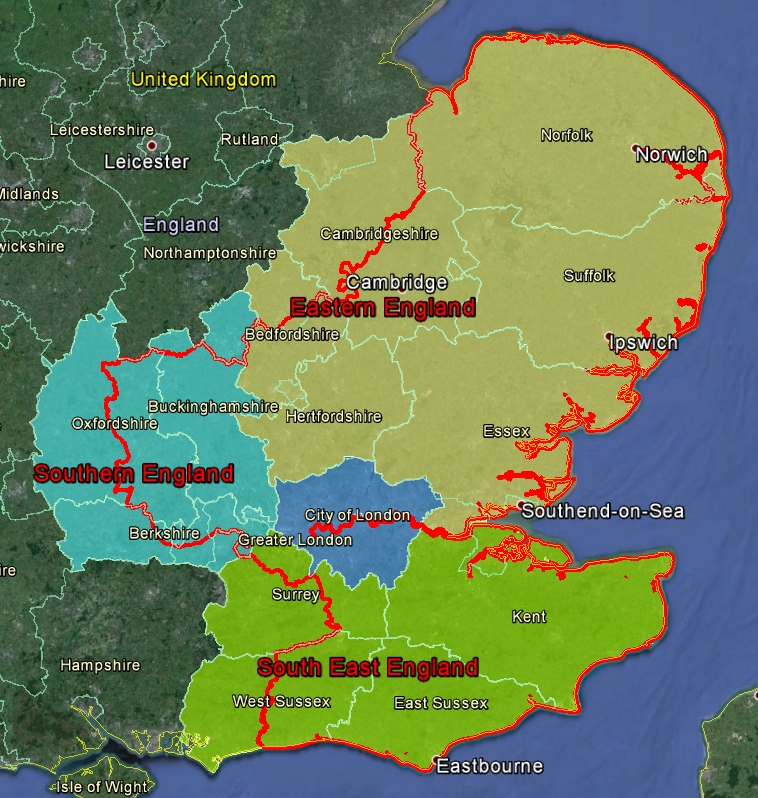
Map of the East England Forest District.
The boundary is the red line which extends through the 3 UK geocaching regions of Eastern England, Southern England and South East England. It also cuts through several counties.