PastMap
Introduction
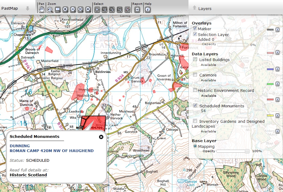
The PastMap lets you find and view historical and archaeological sites in Scotland. It will show you both the area of the site and name as well as a link to Historical Scotland where you'll get more detail including information that will help with getting permission.
The map is quite easy to use but the explanation below will help you get the best out of it.
Finding coordinates to use in the map
The PastMap uses coordinates in the OSGB format - example NO0238914769. To find out how to convert Lat and Long coordinates or get coordinates from Streetmap or Google maps click here.
Using the Pastmap
Click here to open PastMap. You need to be zoomed in to the scale 1:27,000 before you can select any layers to view. Zoom using the buttons in the top left - scale appears bottom right. Once zoomed in select the Scheduled Monuments box in the Layers box on the right. If you know the location simply zoom and pan directly to it.To enter coordinates click the Search button in the toolbar  and enter the coordinates in the OS NGR box. When you find the area click the mouse to display the details.
United Kingdom Reviewers
Dalesman (Yorkshire), GizmoKyla (South Wales, South West England and East Midlands), Hanoosh (Eastern England), La Lunatica (East Midlands), Long Man (South East England), Lorgadh (Scotland), Professor Xavier (Southern England), Royal Oak (North West England), Southerntrekker (London, North Wales, Isle of Man and Channel Islands), Workyticket (North East England and South West England).
United Kingdom Earthcache reviewers:
GeoawareUK2, GeoawareUK4

This work is licensed under a Creative Commons Attribution-NonCommercial-NoDerivatives 4.0 International License.
If you contribute to this wiki, you agree to provide permission to others under this license.
If you share information from this site, you must mention "These regional land policies came from the Geocaching.com Public Wiki and are licensed under a Creative Commons Attribution-NonCommercial-No-Derivatives 4.0 International License."
And, you agree to keep content current by checking back regularly for updates.